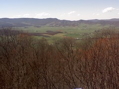
Day 39: This is a picture of God's thumbprint or also known as Burkes Garden. It is a large , crater-shaped depression surrounded all around by high ridges. It was the first choice for the Vanderbuilts to build their Biltmore estate. It was very beautiful. The best thing I have seen in a few days.
Officially we hiked 19.1 miles today. We are 569.4 miles from Springer & 1606.8 miles from Katahdin.
It was nice to have CJ back with us, and his humor! We are staying at the Jenkins Shelter tonight with Matthew, Bobcat & Trailmix. We got a nice fire started cause I rinsed off my clothes today cause they were caked in salt from my sweat. It was bad. They could of stood up by themselves.
3 more days till Amee!
Shepherd.
Showing posts with label AT Mountains. Show all posts
Showing posts with label AT Mountains. Show all posts
Sunday, April 13, 2008
Gods Thumbpint.jpg
Saturday, April 12, 2008
Whitetop Mnt.jpg

Hiked up Whitetop Mnt to Buzzard Rocks. Great views all around. Ate lunch up there for about an hour. Dynamite is chilling out and catching a nap.
Just wanted to post about it. More to come!
Shepherd.
This message was sent using the Picture and Video Messaging service from Verizon Wireless!
To learn how you can snap pictures and capture videos with your wireless phone visit www.verizonwireless.com/picture.
To play video messages sent to email, QuickTime 6.5 or higher is required. Visit www.apple.com/quicktime/download to download the free player or upgrade your existing QuickTime Player. Note: During the download process when asked to choose an installation type (Minimum, Recommended or Custom), select Minimum for faster download.
Thursday, April 3, 2008
Hump Mountain.jpg

Day 29: Wonderful day for hiking. To God be the glory. This picture is of CJ hiking up Hump Mnt. In the distance you can see little hump mnt & Bradley's gap. This area is by far the most beautiful part of the trail to date. 360 degree views, took lots of pics and some video. Amazing. God's creation is beautiful. Worth the climb over Roan.
Well today we planned on hiking 17.4 miles but when do we listen to reason. We then decided to hike another 3.8 miles to Abby's place hostel. Well found that was closed for 2008, so we decided to hike onwards another 2 miles and camped at hardcore cascades. Officially, we hike 23.2 miles, and 401.6 miles from Springer.
So today we officially said goodbye to NC. 2 states down & 12 more to go. Plus we broke into the 400 mile territory! Yeah.
Then we will take a nero at Kincora hostel to resupply for Damascus push.
Happy birthdaty dad! Love ya!
Shepherd.
Wednesday, April 2, 2008
Jane Bald.jpg
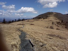
Day 28: Well today was a beautiful day for hiking. God is great! He is even if it rained today. Wonderful views from Jane Bald and Grassy ridge. Thx Lakewood & PS for the heads up. Took lots of pics!
Officially did 12.9 miles, but that included Roan mnt. Our last 6000 ft mnt till NH. It was tough but not horrible. Did groan a few times though. It is a multi-tear mnt, so you go up & level off like 7 times before getting to the top! The southbounders have it easy going up Roan, it was very easy downhill!
Officially we are 377.9 miles from Springer & 1798.3 miles from Katahdin. We are in an old barn converted to a shelter with great views. Overmountain Shelter. CJ, Dynamite & Sam (now called Cowboy Killer) are here as well.
God bless,
Shepherd
Pine forest.jpg
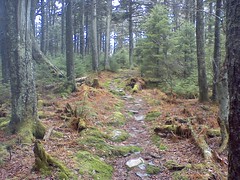
Day 27: Praise God we made it to our shelter safe & sound. The day started off ominous with the threat of rain, and everyone was sick from the chinese yesterday. CJ couldn't even eat his Sonic breakfast buritto! Well we left the hostel at 9 am, planning to do 16.6 easy miles since it is all uphill & our packs are full of food.
Well CJ had this brilliant idea about half way to the shelter to go on to the next shelter since thunderstorms were forecasted tomorrow. Well once we did the 16.6 miles, we found out the next shelter was 8.8 more miles. So what did we do, you guessed it. We hiked on!
So officially we hiked 25.2 miles, the longest yet. We are 365 miles from Springer & 1811.2 miles from Katahdin. Yes we are lean mean hiking machines, but only plan to do 12.9 miles tomorrow! We got into the shelter at 7:15 pm.
The views from beauty spot were awesome, plus the pine forest on top of Unaka mnt was something out of a movie set.
Tomorrow is Roan mnt! Yeah baby.
Shepherd
Monday, March 24, 2008
Walnut Mnt Shelter.jpg
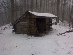
Day 20: Well we are lean mean hiking machines now. We left the hostel around 9:30, when it started snowing and it hasnt let up yet. Officially we hiked 20.3 miles. I wanted to call it quits at 15.4 miles but CJ and Jens talked me into another 4.9 miles. I am thankful they did, because that leaves us with only 13.1 miles to Hot Springs. That means we might get there for lunch! Yeah baby!
Well we are officially 258.8 miles from Springer & 1917.6 miles from Katahdin.
Well it was snowing when we went over Snowbird mnt, so no views. But God allowed the weather to break when we went over Max Patch. It was even more spectacular than I had imagined. Scott & Lakewood thanks for the heads up. It was still chilly...temp 30 degrees with 15-20 mph winds, so I didnt get to stay up there long. Did enjoy a Snickers up there though. Great pictures.
So far it has snowed about 1.5 inches. They are calling for 1-3 inches. Glad I am not in the Smokies!
Get to see Amee tomorrow! Yeah!
Friday, March 21, 2008
Clingmans Dome.jpg

Day 17. California Joe & I surfaced to civilization today at Newfound Gap. It is full of tourists here, and we even got our picture taken by a very astonished couple from Chicago. They could believe we have been hiking for 17 days straight.
Today we summitted Clingmans Dome. The highest point on the AT at 6643 ft. It was a great day to view!
Also at lunch we crossed the 200 mile mark on the trail! We are staying at Ice Water Spring shelter tonight, which is 207.6 miles from Springer.
We have about 2 more days of the Smokies, and are on schedule to get to Hot Springs on Tuesday. God Bless. Hope the Passion Play is going well. To God be the glory.
Shepherd.
Sunday, March 16, 2008
Wesser Bald Observation Tower.jpg
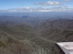
This is the view from Wesser Bald. Since yesterday wasnt a good day for viewing the scenery from Wayah Bald, God allowed me to see it today! And what a site it was. You could see for miles 360 degrees...mountains everywhere! This is the view toward Fontana Dam and the Smokies, which I will come to real soon.
The Mighty One, God, the LORD, speaks and summons the earth
from the rising of the sun to the place where it sets.
Psalm 50:1
Thursday, March 13, 2008
Standing Indian Mnt View.jpg
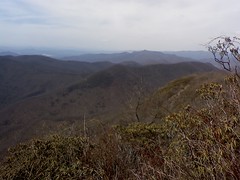
Well I made it to the summit at 1:50. Temp 64.5 degrees & a pressure of 856.4 mb, which is the lowest reading yet. I am at 5,498 ft up and sitting on a rock ledge over looking the mnts I have just been through. I can even see Hiawassee. Words or pictures of course cant say or show the coolness of the view. 6.1 more miles to the shelter. God is good, and His creation is amazing...even with the fall.
Monday, March 10, 2008
Tray Mnt overlook.jpg
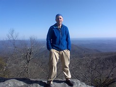
Well it is 5 pm and we are just chilling on this amazing overlook from Tray mnt. It is a great place for the sunset. We did 7.8 miles today. I dont have my data book handy to give official mileage. Tomorrow we are headed to the Blueberry Patch hostel in Hiawasee, where I will have my 1st shower in 7 days. Will also do laundry. Their breakfast is legendary. The view here is amazing and I doubt the picture does it justice. I will also resupply my food bag as well. 2 more days and I will be in NC saying goodbye to GA. Yeah!
Sunday, March 9, 2008
Blue Mountain Shelter.jpg

Howdy from Blue Mnt shelter. we officially hiked our biggest mileage today, and my feet are sore! We hiked 13.8 miles and are now 48.7 miles from Springer & 2127.5 miles from Katahdin. After lunch we hiked through 4 named gaps, so we must of hiked 4 mnts as well. Blue Mnt was the worst. Very rocky. We have an awesome view right out the front. There are a few thruhikers here & a lot of college students out on spring break. I know that isnt my wifes idea of a spring break. lol. Planning a short day tomorrow to rest our feet, but there are some tough climbs in store. Oh, no wind! Yeah. It is a beautiful night. I am getting my appetite back, and I hear an all you can eat Chinese buffet calling my name in Hiawasee! Yummy! God bless.
Shephard
Saturday, March 8, 2008
Blood Mountain.jpg

Hiked up Bloood mnt in the snow. Actually it was a very easy climb compared to the last few days. Maybe I am actually getting in shape. Hiking up it reminded me of the LOTR scene where Gandof was leading the group through the mnt pass. Matt..the pressure was 874 millibars on top of the mnt...and 26 degrees not including the wind chill. Lowest pressure so far.
Tuesday, March 4, 2008
Springer mountain.jpg
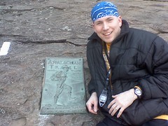
Amee & I at the summit of Springer. We decided to hike to the top today, so Amee could leave first thing in the morning to get back to IN. The trail was a river of water from rain this morning. The view from the top was breath taking! Signed the register & took some pics. Me at the 1st white blaze and plaque. Amee is glad she isnt hiking the trail! lol I on the other hand can't wait! Will enjoy this last night of comfort.
Subscribe to:
Posts (Atom)

